Printed Star Chart or Phone App for Finding Constellations?
Compare a printed star chart and phone app for finding constellations, then choose the tool that fits your route, sky conditions and observing plan.
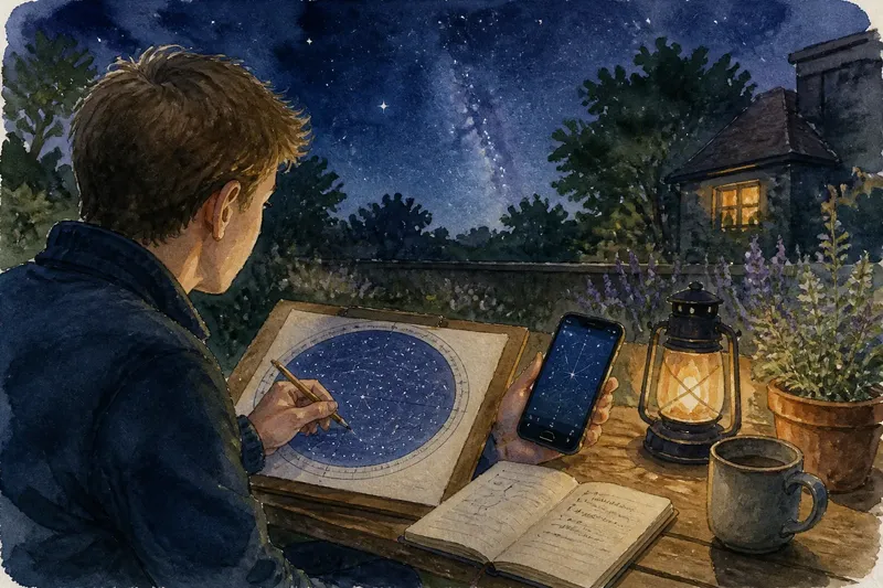
You step into the garden to find Orion, but the familiar belt is lost among the stars. For finding constellations, a printed star chart or phone app can help—but each works differently as a map, a teaching aid and a record of what you have seen.
A printed star chart teaches you to read the sky as a map
A paper chart gives you a stable picture of a region: bright stars, constellation outlines and, on more detailed maps, objects beyond naked-eye view. A planisphere is a particular kind of chart, with a rotating window that you set to the date and time to reveal which stars should be visible.
That fixed layout asks you to make the connection between the map and the sky yourself. It can be a satisfying way to learn how constellations sit beside one another, rather than treating each bright point as a separate name to look up.
Paper also makes it easy to mark a route with a pencil, circle a pattern you want to revisit or jot down a question beside a chart. A clipboard helps keep a loose sheet steady; a folded map can expose just the area you are using.
A phone app acts as an interactive sky atlas
A sky app can place names and constellation lines over a live view, often using the phone’s location, clock and motion sensors. This is useful when you are unsure which patch of sky a paper map represents, or when you want to check a particular star’s name without tracing a longer route.
Apps vary. Some emphasise a simple naked-eye view, while others offer object catalogues, adjustable labels or simulated views for different dates. Before choosing one, check that its display is readable to you, that you understand its controls and that it can show the kind of information you actually want.
The phone’s sensors are not infallible. If the sky overlay seems displaced, check the selected location and time, then compare the app’s directions with a compass or a known landmark. Treat the screen as a guide to check against the sky, not as the sky itself.
Choose by the job you want the map to do
Rather than asking which format is best in general, start with the task. A planned route through familiar constellations favours a chart you can prepare in advance; a spontaneous question about an unfamiliar bright point may favour an app.
- Check whether you have a specific region in mind: if you do, choose a chart that covers it clearly; if not, use an app’s broad sky view or select a chart with a larger horizon-to-horizon layout.
- Check whether you need names as you observe: if quick labels matter, use an app with a clear sky overlay; if learning the patterns matters more, start with a simple printed map and consult a reference only when needed.
- Check whether you will be walking while observing: if you need both hands free, keep a folded chart in a pocket and stop before consulting it; alternatively, prepare the app’s controls before setting off and use it only while standing still.
- Check whether you are leading a group: if everyone needs to see the same map, use a large printed chart or show the app briefly to settle one question, then return attention to the shared sky.
- Check whether you want to annotate what you see: if notes and marked routes will help, take paper and a pencil; if you prefer a clean map, use an app that lets you save observing notes or keep a separate notebook.
- Check whether your intended app features need a connection: if they do, prepare them before going somewhere without reception; if they do not, confirm the relevant maps or sky data are available offline, or take a paper chart instead.
Say you have an invented plan to find the Summer Triangle from a garden and make notes about the surrounding stars. You start with a printed seasonal chart and a pencil, then discover that a bright point near the pattern is not labelled clearly enough for your question. You consult an app for that identification, write the name on the chart and put the phone away; the result is a paper route with one specific uncertainty resolved, though the app would be the more convenient main tool if new questions kept arising.
Set up each format for the sky you expect
For a planisphere, align the date and time before going outside, then check that its horizon markings and labels make sense to you. A fixed seasonal chart needs no adjustment, but you still need to know which direction its map represents and which region it covers.
For an app, enter or confirm the location and time settings, and open the sky view before you start observing. If you intend to use it offline, check the app’s own instructions and make sure the relevant information has been prepared; available features differ between apps.
Keep the map easy to consult. For paper, fold or position it so the active region is visible. For a phone, learn how to change the view and orientation before you are outside, and close features you do not need.
How do you choose and use a constellation map?
Should I start with a planisphere or a star chart?
A planisphere is useful for seeing which broad patterns are above the horizon at a chosen time and date. A fixed chart can be simpler if you want to study one particular region without adjusting a rotating window.
Can a sky app work without mobile reception?
Some features may work offline if the app has the needed sky data stored on the phone. Check the app’s settings and instructions in advance, and carry a paper map if an offline feature is essential to your plan.
What should I do if the app’s sky overlay is misaligned?
Check the location and time, then compare the app’s direction with a compass or a landmark you recognise. If its sensor-guided view still disagrees with the sky, switch to a manual view or use a chart.
Can I use a printed chart and an app together?
Yes. Use paper to follow the broad pattern or make notes, then open the app to answer a specific identification question; the two formats need not compete for the same job.
Pick the tool that supports the way you observe
A printed star chart is strongest when you want a settled map to study, annotate or share without relying on a device. A phone app is strongest when you need flexible views, quick labels or help with a question that changes as you look around.
For finding constellations, let the task decide: prepare a chart for a chosen route, or configure an app when exploration and immediate identification matter more. If neither option feels sufficient, combine them—a chart can hold your bearings while the app answers only the question that paper leaves open.